Webcams & Weather
Webcams
View all webcams - Click Here
North Webcam (HD)
Arthur's Pass Village
Weather Station
West Webcam (HD)
Arthur's Pass Village
Weather Station
Repeater Webcam (HD)
Temple Basin View
Weather Station
Repeater Webcam (HD)
South View
Weather Station
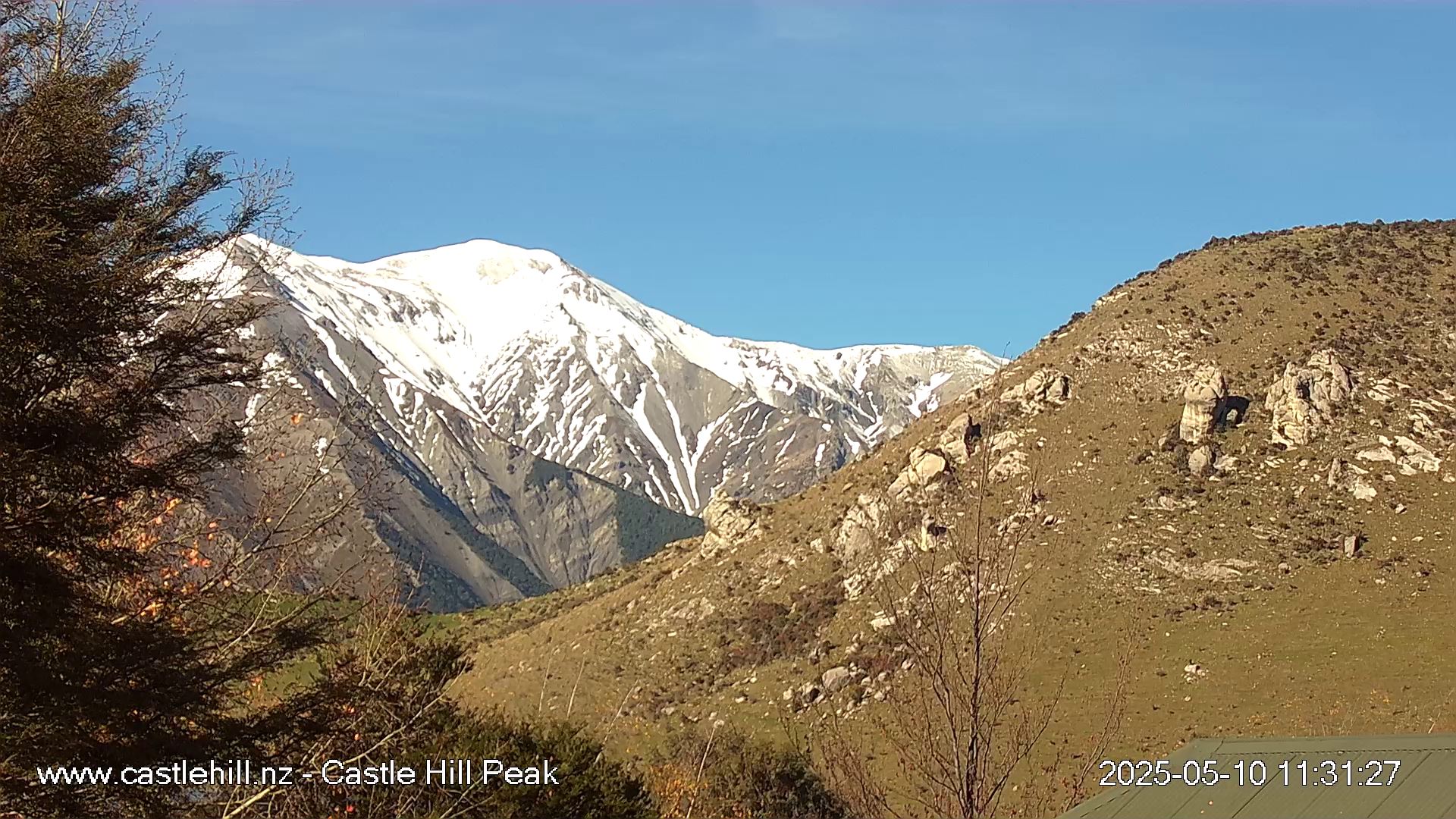
Castle Hill Peak
Castle Hill Village
Image is provided with permission of www.castlehill.nz

Mt Cloudesley
Castle Hill Village
Image is provided with permission of www.castlehill.nz
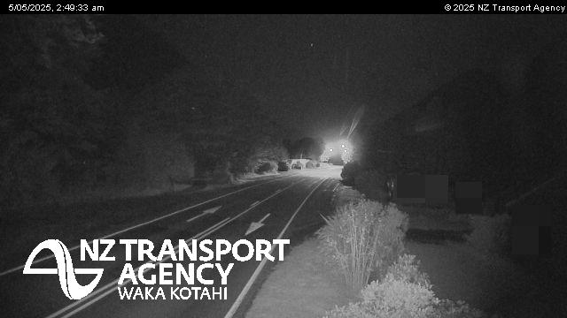
South View
Arthur's Pass Village
Image is provided with permission of Waka Kotahi (NZTA)
Weather Forecast
| SEVERE WEATHER POSSIBLE IN NEXT 5 DAYS! | |||||
| Saturday 4 Jul 3º / 7ºC | Sunday 5 Jul -1º / 5ºC | Monday 6 Jul -1º / 3ºC | Tuesday 7 Jul -2º / 3ºC | Wednesday 8 Jul 0º / 4ºC | Thursday 9 Jul -2º / 3ºC |
| Click for more information Update:04/07/26 05:30hrs | |||||
Forecast Links
Local Weather Station
Click Here for AP Wx Station 1 dataClick Here for AP Wx Station 2 data
Click Here for Goldney Station 3 data
THIS STORM CYCLE (15hrs)
Storm is currently in a lull period of 1hr.
Rainfall: 12.8mm
High Rain Rate: 3.2mm/hr @ 2:01hrs 4/7/26
Temp Low: 6.2ºC @ 19:57hrs 3/7/26
Temp High: 7.4ºC @ 1:57hrs 4/7/26
Wind Gust: 64kmph @ 11:27hrs 3/7/26
Dom.Wind Dir: West
Barometer Low: 1014mb @ 4:57hrs 4/7/26
Update: 4/7/26 5:32hrs NZST
Sunrise: 8:06hrs
Sunset: 17:12hrs
Temperature: 6.9ºC (Falling)
Temperature (Low): 6.7ºC
Temperature (High): 7.4ºC
Wind Chill: 6.9ºC
Humidity: 91% (Rising)
Barometer: 1013.42mb (Falling)
Wind Speed: 8km/h
Wind Direction: NW
Wind Gust: 63km/h (2:32hrs)
Cloud Base: 1189m ASL
Freezing Level: 2145m
Lapse Rate: -0.424ºC/+100m
Daily Rainfall: 7.6mm
Hourly Rain: 0mm/hr
24 Hour Rain: 13mm
2026 STATISTICS (View Database)
High Temp: 26.7ºC (11/2/26)
Low Temp: -3.4ºC (18/5/26)
High Wind Gust: 111kmph WNW (20/6/26)
High Rain: 217.6mm (11/1/26)
Last Rain (>5mm): 4/7/26 (0 days, 7mm)
Annual Rainfall: 1977.4mm
Rain Days: 71 / 185 (38%)
Remote Weather Stations
(Data provided by ECAN & WCRC)Carrington Hut (04/07/2026 - 04:30hrs)
Daily Rainfall: 11.5mm
2 Day Rainfall: 27mm
3 Day Rainfall: 27mm
7 Day Rainfall: 27mm
Mid Poulter River (04/07/2026 - 04:00hrs)
Daily Rainfall: 1.5mm
2 Day Rainfall: 1.5mm
3 Day Rainfall: 1.5mm
7 Day Rainfall: 1.5mm
Grasmere Stn (04/07/2026 - 04:30hrs)
Daily Rainfall: 0.0mm
2 Day Rainfall: 0mm
3 Day Rainfall: 0mm
7 Day Rainfall: 0.5mm
Mt Cheeseman (04/07/2026 - 04:30hrs)
Daily Rainfall: 0.0mm
2 Day Rainfall: 0mm
3 Day Rainfall: 0mm
7 Day Rainfall: 0mm
Upper Styx River (04/07/2026 - 03:10hrs)
6hr Rainfall: 1.2mm
24hr Rainfall: 31.1mm
7 Day Rainfall: 52.1mm
Upper Wilberforce River (04/07/2026 - 04:00hrs)
Daily Rainfall: 0.0mm
2 Day Rainfall: 60.5mm
3 Day Rainfall: 68mm
7 Day Rainfall: 201mm
Wilberforce River in flood!
Upper Taramakau River (04/07/2026 - 04:00hrs)
Daily Rainfall: 12.0mm
2 Day Rainfall: 20mm
3 Day Rainfall: 20.5mm
7 Day Rainfall: 20.5mm
Goldney Ridge (04/07/2026 - 05:48hrs)
Daily Rainfall: 12mm
2 Day Rainfall: 32mm
3 Day Rainfall: 32mm
7 Day Rainfall: 32mm
West flow rivers are high!