Craigieburn Forest Park - Full Day Tramps
All of these tramps go into difficult, and potentially severe alpine terrain. Trampers MUST BE be prepared with suitable equipment and supplies, particularly water, as none can be easily obtained on thee routes. Many of these routes travel through avalanche terrain, and it is recommended to avoid these areas in Winter/Spring.
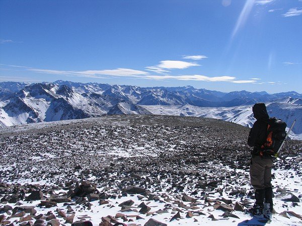
Leith Hill (1384m)
Track Grade: Marked Track and Unmarked RouteWalking Time: 4-6 Hours Return from carpark
Features: Wide mountain views
Restrictions: No Mountain Biking
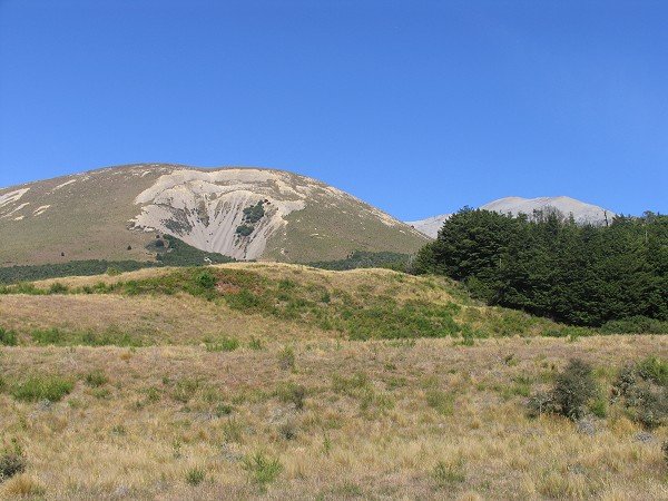
Location: The best place to start this track is Thomas Bush car park. The carpark is located about 200m beyond the end of the Castle Hill village (houses) on Castle Hill Drive.
See the description for the Leith Hill Loop Track. From the high point on the loop track, fit, experienced, well-prepared parties could climb to the summit of Leith Hill on an unmarked route. This should only be attempted in good visibility, and when there is no snow on the ground.
Climb the steep scrub covered hillside to the southwest, on reaching the more open ridge continue climbing the obvious ridge, avoiding the loose ground and steep gullies where necessary. The overall climb to the summit ascends 370m over 1km. Return the same way. Climbing time is normally 1-2 hours one way from the Loop Track.
Climb the steep scrub covered hillside to the southwest, on reaching the more open ridge continue climbing the obvious ridge, avoiding the loose ground and steep gullies where necessary. The overall climb to the summit ascends 370m over 1km. Return the same way. Climbing time is normally 1-2 hours one way from the Loop Track.
Mt Cloudsley (2107m)
Track Grade: Walking Track and Unmarked RouteWalking Time: 6-8 Hours Return from carpark
Features: Wide mountain views
Restrictions: No Mountain Biking on Mt Cloudsley
Location: This unmarked route can be accessed from Hogs Back Track. The best place to start this track is Thomas Bush car park. The carpark is located about 200m beyond the end of the Castle Hill village (houses) on Castle Hill Drive.
From the junction of the Easy Up track and the Hogs Back Track, fit, experienced, well-prepared parties could climb to the summit of Mt Cloudsley on an unmarked route via Long Spur. This should only be attempted in good visibility, and when there is no snow on the ground.
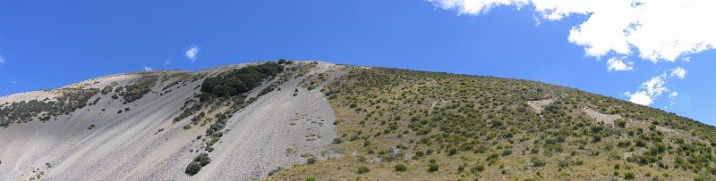
From the fence line near the end of the Easy Up track, initially follow the rough track on its left side for about 150m before climbing the hillside through tussock and scrub towards the obvious open ridge above. The ridge is easily followed.
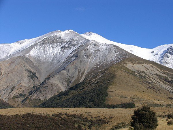
Ridge vegetation is lost at 1500m, continuing on scree and through short sections of rocky outcropping. At the 1855m point, follow the ascending ridge for a further 1.1 km to the broad, open summit.
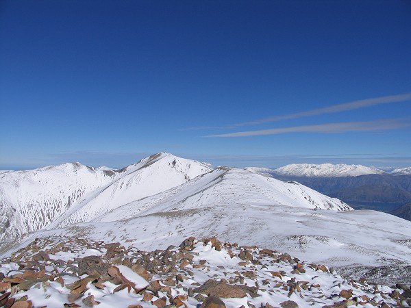
From Mt Cloudsley there are spectacular views south into the headwaters of the Wilberforce and Rakaia Rivers, and an expansive view towards the Torlesse Range and Castle Hill Peak. Return the same way.
From the fence line near the end of the Easy Up track, initially follow the rough track on its left side for about 150m before climbing the hillside through tussock and scrub towards the obvious open ridge above. The ridge is easily followed.
Ridge vegetation is lost at 1500m, continuing on scree and through short sections of rocky outcropping. At the 1855m point, follow the ascending ridge for a further 1.1 km to the broad, open summit.
From Mt Cloudsley there are spectacular views south into the headwaters of the Wilberforce and Rakaia Rivers, and an expansive view towards the Torlesse Range and Castle Hill Peak. Return the same way.
Mt Cloudsley - Mt Enys Traverse
Track Grade: Walking Track and Unmarked RouteWalking Time: 8-12 Hours Return from carpark
Features: Wide mountain views
Restrictions: No Mountain Biking on Mts Cloudsley/Enys
Location: This unmarked route can be accessed from Hogs Back Track. The best place to start this track is Thomas Bush car park. The carpark is located about 200m beyond the end of the Castle Hill village (houses) on Castle Hill Drive.
Mt Enys (2194m) is the highest point in the Craigieburn Range. There is an unmarked route from Mt Cloudsley to the Mt Enys Summit.
It is very important to only attempt this unmarked route in good weather and visibility. This area is extremely hazardous in wet, windy or low visibility conditions.
The area around Mt Enys can have extreme avalanche danger in winter conditions, irrespective of the general avalanche rating for the area. We strongly advise that you do not attempt this trip if there is snow present.
Only attempt this trip if you are a confident, fit, experienced backcountry alpine tramper, with good gear and in favourable conditions.
Ascend Mt Cloudsley via the Long Spur Route (see above). From Mt Cloudsley (2107m), descend southwards, staying on the broad open ridgeline. Ascend from the saddle to the 2089m point. Keeping the summit of Mt Enys in sight, descend the narrow joining ridge into another saddle 100m lower.
The final ascent on the Mt Enys is made up a steep, winding ridge to the summit. From the summit you can see the entire Craigieburn Range, with views into the Arrowsmith Ranges in the south. Return the same way.
Note: It can be tempting to return via Carn Brea (2090 m) and Dead Man Spur. While this is possible, it is important to note that a return trip to Castle Hill Village needs to go over Leith Hill, staying above 1100 m to avoid the private farmland of Castle Hill Station.